History of a Painting
start

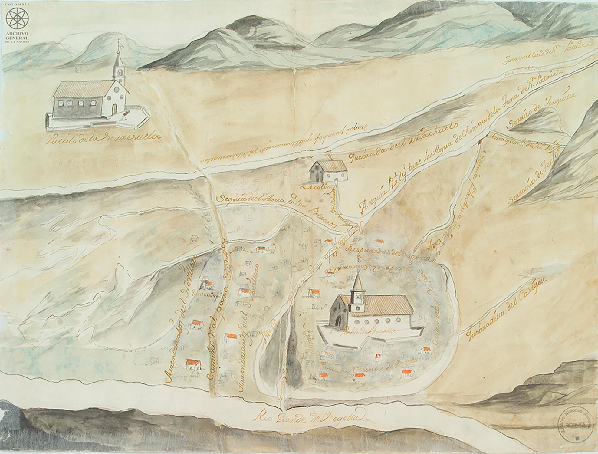
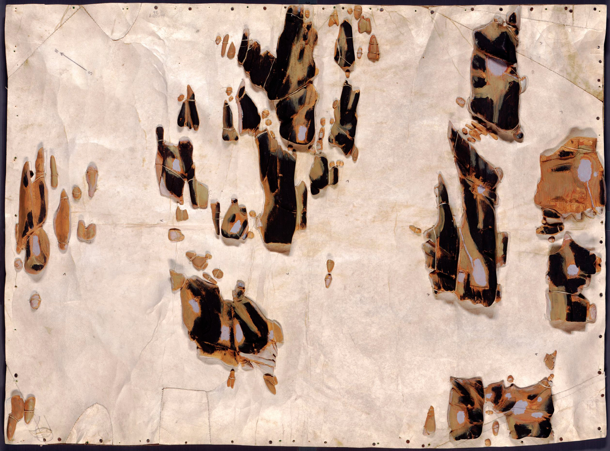
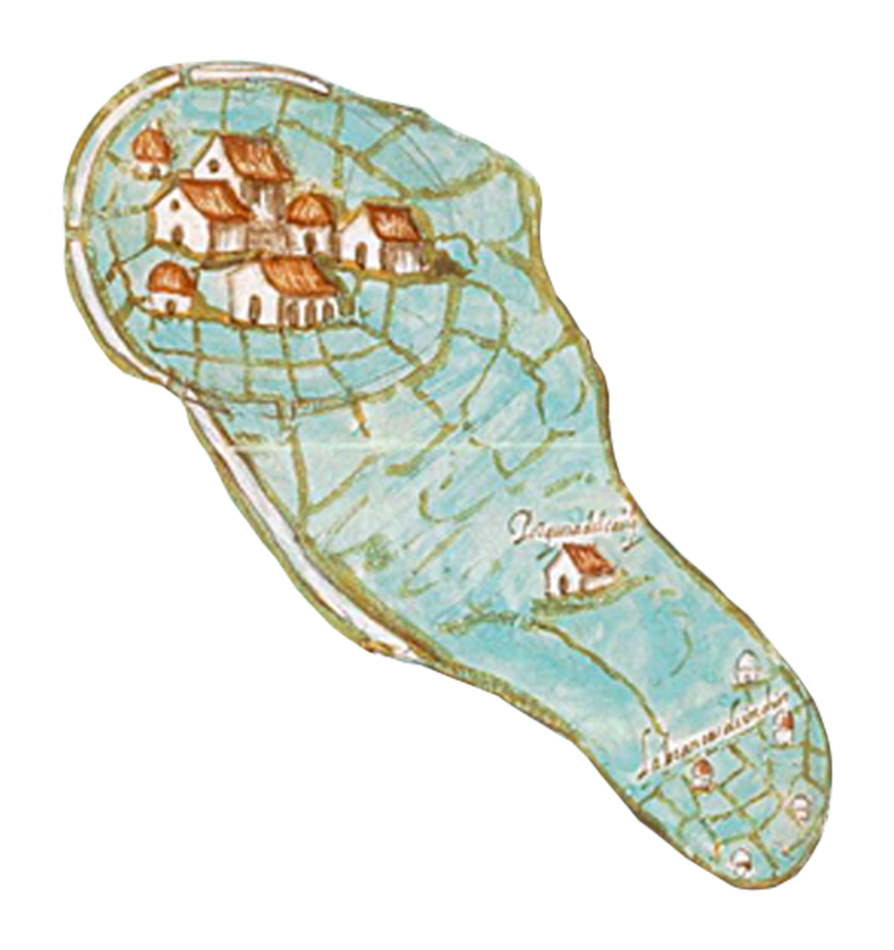
The Painting of the lands, marshes, and swamps of the town of Bogotá was presented as evidence during a 1614 legal proceeding brought by the crown prosecutor of the New Kingdom of Granada against Francisco Maldonado y Mendoza, a renowned encomendero, over the ownership of lands in the Bogotá savanna.
 Learn more
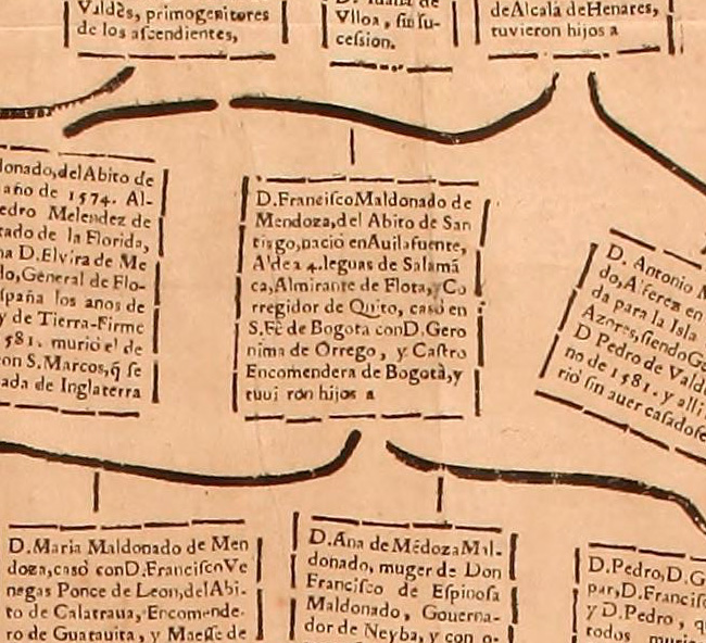
Francisco Maldonado y Mendoza was born in Spain in 1551 and moved to Santa Fe de Bogotá in 1583. In 1586 he married Jerónima de Orrego, the daughter and sole heiress of the conquistador Alonso de Olalla.
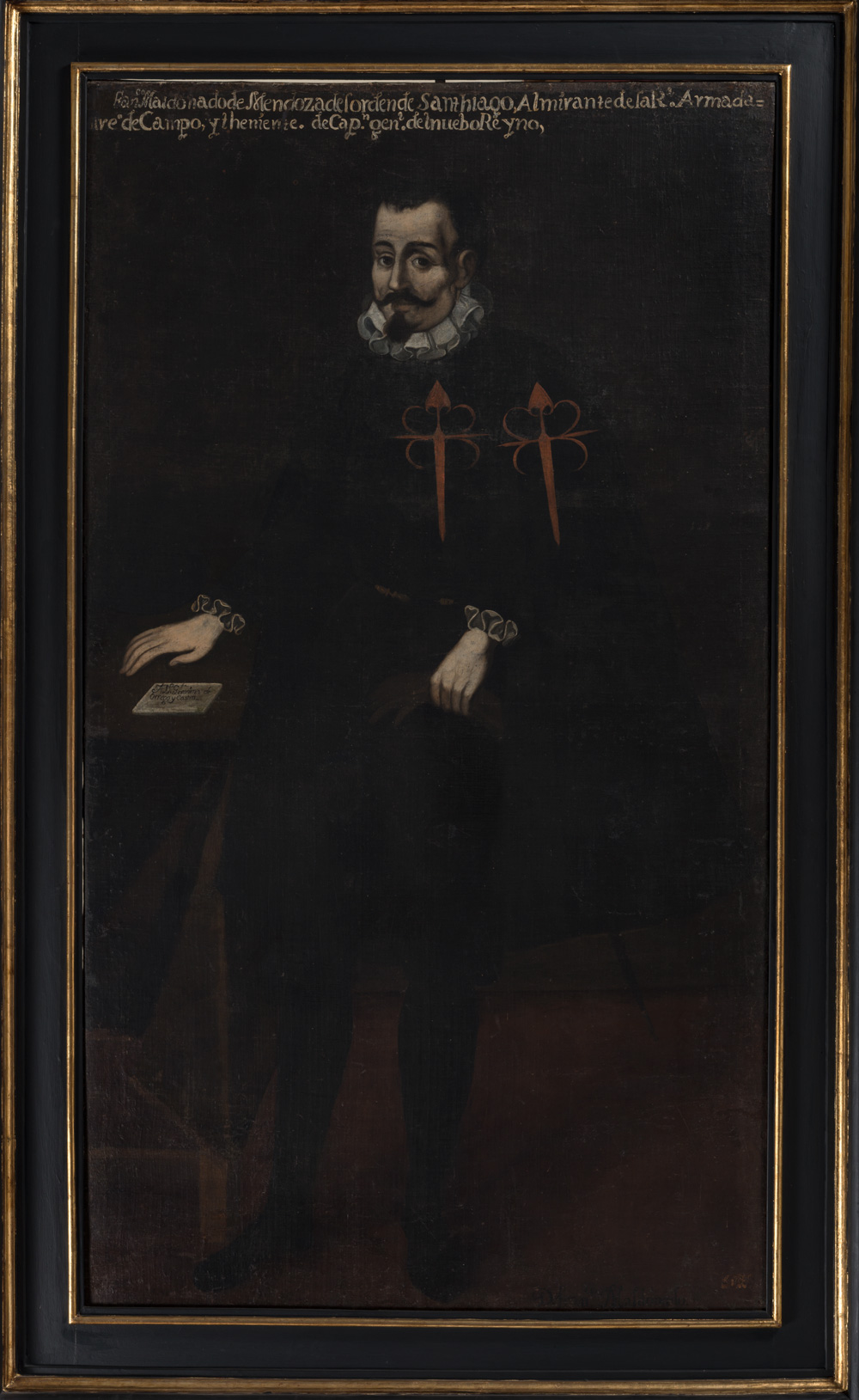
Francisco Maldonado y Mendoza. Anonymous, eighteenth century. Courtesy of the Museo Colonial, Bogotá. [Source C1.04]
That year, Maldonado y Mendoza began purchasing estates in the Bogotá savanna and receiving lands awarded by the Spanish Crown. By the mid-1590s, Maldonado y Mendoza was not only the encomendero of the Indigenous community of Bogotá, but also owned one of the most prosperous cattle ranches in the New Kingdom of Granada.
The crown prosecutor of the New Kingdom of Granada sued Maldonado y Mendoza in 1603, accusing him of having defrauded the monarchy by buying vast, fertile lands at a very low price. During the litigation, both parties presented opposing visions of the territory. While Maldonado y Mendoza described it as an unproductive marsh, the prosecutor considered it to be fertile savanna. During the case, this map was meant to serve as proof to determine which party was correct. For this purpose, imperial officers were ordered to explore the territory, see it with their own eyes, and draw it on paper so that it could be presented in court to help reach a decision. As they sketched their observations on paper, the savanna became an object of study for the court in accordance with the monarchy’s legal framework.
 Primary Source
Francisco Maldonado y Mendoza. Anonymous, eighteenth century. Courtesy of the Museo Colonial, Bogotá. [Source C1.04]
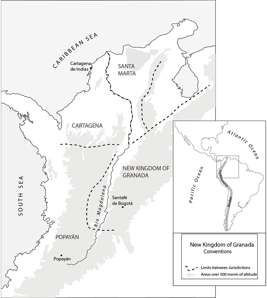
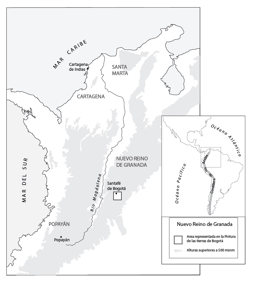
The map features the Bogotá savanna, a high plateau on the eastern mountain range of the northern Andes in modern-day Colombia. In the early sixteenth century, the savanna was occupied by the Indigenous Muisca people of the Chibcha linguistic family. A Spanish expedition led by Gonzalo Jiménez de Quesada arrived there in 1536. From that moment on, the city of Bogotá became the base of operations for the Spanish empire in the region and was designated as the seat of the audiencia of Santafé in 1549.
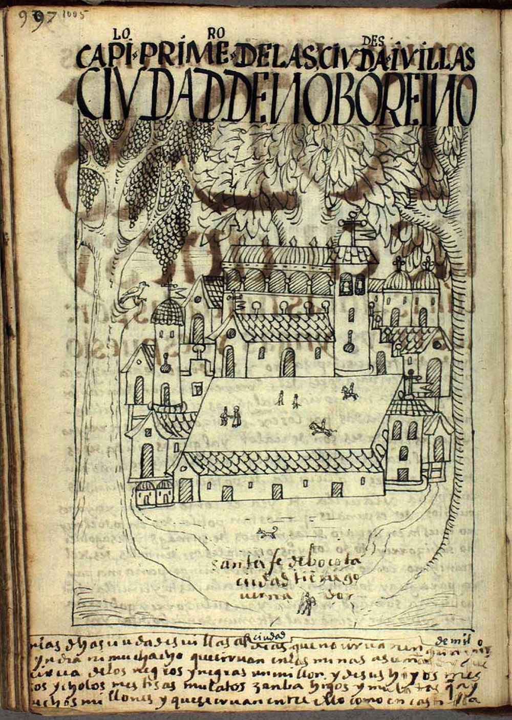
Drawing of Santa Fe de Bogotá “Capítulo primero de las ciudades y villas: ciudad de Nuevo Reino, Santa Fe de Bogotá, ciudad tiene gobernador.” Guamán Poma, 1615
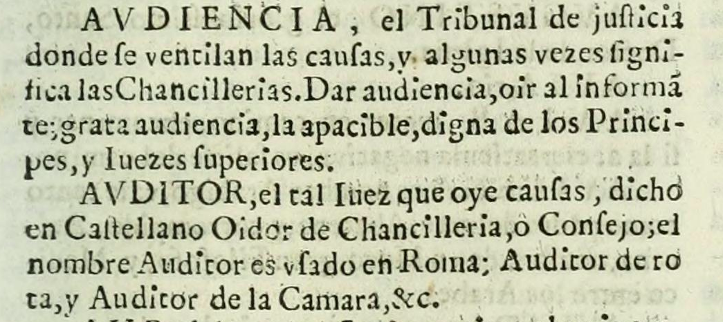
AUDIENCIA, the court of justice where motions are heard, it sometimes refers to chanceries. To give a hearing, to hear an informant, a welcome hearing, the serene, worthy of princes and supreme justices.
Tesoro de la lengua castellana, o Española. Sebastián de Covarrubias Orozco 1611. Courtesy of John P. Robarts Research Library, Toronto. [Source C1.02]
On the creation of Audiencias. Recopilación de Leyes de los Reinos de las Indias. See full document
Drawing of Santa Fe de Bogotá. “Chapter primero de las ciudades y villas: ciudad de Nuevo Reino, Santa Fe de Bogotá, ciudad tiene gobernador”. Guamán Poma, 1615
AUDIENCIA, is the justice court where motions are heard, sometimes used to refer to chancellorships. To give a hearing, to hear an informant, cordial hearing, the serene, worthy of princes and supreme justices.
Tesoro de la lengua castellana, o Española. Sebastián de Covarrubias Orozco 1611. Courtesy of John P. Robarts Research Library, Toronto. [Source C1.02]
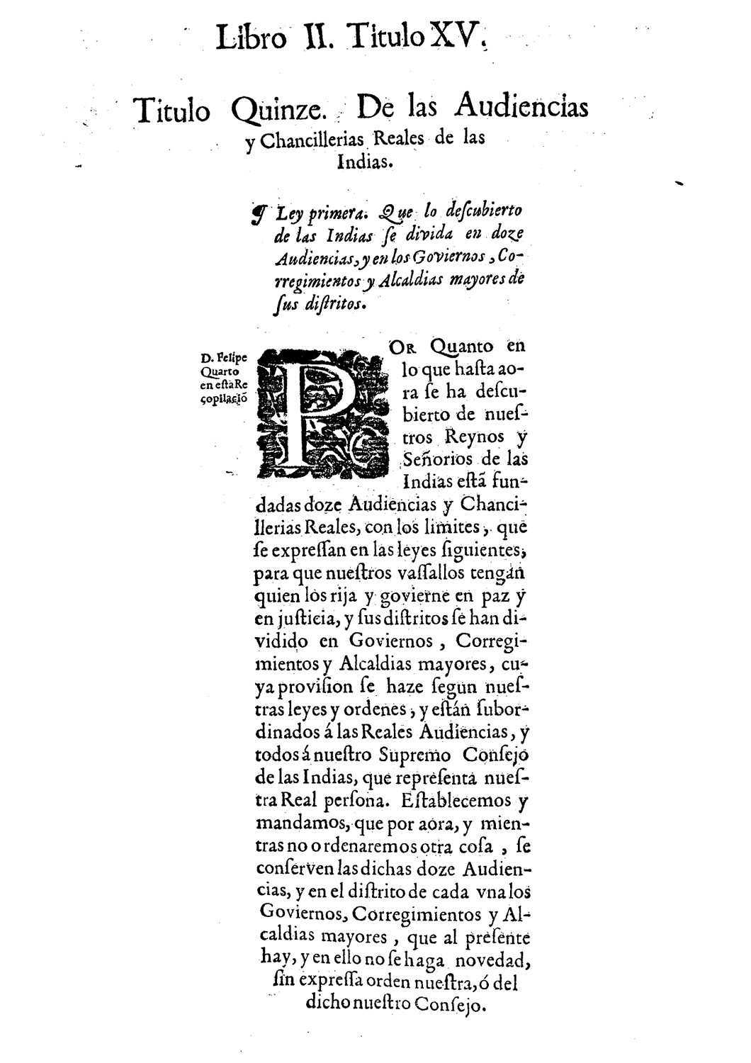
On the creation of Audiencias. Law One. Everything that has been discovered in the Indies is to be divided into twelve audiencias, and into governments,corregimientos, and alcaldías mayores of the districts.
Over what has been so far discovered in our kingdoms and dominions in the Indies, we have established twelve audiencias and royal chanceries (…) so that our vassals have someone to rule them and govern them in peace and justice.
Recopilación de Leyes de los Reinos de las Indias. Mandadas imprimir y publicar por la magestad católica del Rey don Carlos II. Libro II, título XV. Recopilación de Leyes de los Reinos de las Indias. Mandadas imprimir y publicar por la magestad católica del Rey don Carlos II. Libro VI, título III. Julián de Paredes, 1681. Courtesy of Biblioteca Nacional de España, Madrid. [Source C1.03] See full document
The Painting of the lands, marshes, and swamps of the town of Bogotá is a manuscript that works both as a map and as a landscape painting and belongs to the genre of legal maps.
Learn moreWhile most legal maps were outlines or simple plans, this map is special not only for its use of color and elaborate designs, but because it is signed by its author, Juan de Aguilar Rendón, who identified himself as painter, and Alonzo Ruiz Gadálmez, the guarantor
The full title is Painting of the lands, marshes, and swamps of the town of Bogotá, made by order of the Royal Audiencia of this city of Santafé of the New Kingdom of Granada, for proceedings between the crown prosecutor and don Francisco Maldonado de Mendoza. By us, Alonso Ruiz Gadálmez, receptor, and Juan de Aguilar Rendón, painter, in the month of April of the year 1614.
The acknowledgement of authorship is a rare occurrence both in legal maps and in colonial paintings in the New Kingdom of Granada. At the time, the concept of authorship itself had a very different meaning from the one we use today. The signature, the use of the term “painting,” and the use of color are indications that the author was also creating a piece that could be appreciated for its aesthetic qualities.
Moreover, the signatures of the painter and guarantor ensured the validity of the land survey and legitimized its use in court as a truthful representation of the territory.
Although we do not know the origin of the paints used on the map, the production of inks and colors was a complex process involving vegetable and animal pigments that were then transformed into paint using methods rich with cultural significance. We have evidence that the Muisca and other Indigenous groups used a wide palette of blue, red, and brown pigments which they applied to designs on textiles, rocks, and other surfaces. For this reason, it is possible that some of the colors used in the Painting were produced using Indigenous methods.
Another important aspect of the Painting’s visualization of the landscape is its scale. Unlike contemporary maps, which guarantee precision by maintaining a single scale throughout the image, the Painting uses a multiple, flexible, and variable scale. The center of the map—which represents the territory disputed by Maldonado y Mendoza and the crown prosecutor—uses a more homogeneous scale, whereas the borders are variable, allowing the observer to see relatively remote landmarks like the city of Santafé and the towns of Fontibón and Madrid as points of reference.
Primary SourceDifferent societies depict the world in different ways. There are visual, oral, and mental maps. In some societies, a name, a hat, or clothes can also serve as a map.
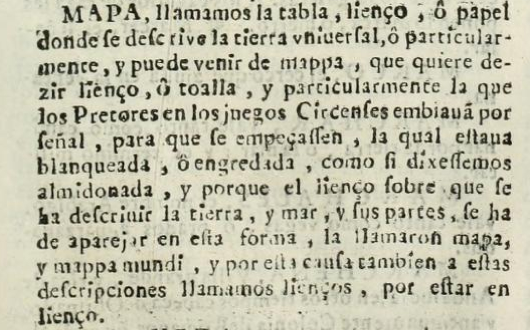
“MAP, is what we call the board, canvas, or paper in which all or particular lands are depicted, it may come from mappa, which means canvas or fabric, particularly the ones praetors in the circus would send as a signal for the games to begin, which was whitened or treated with clay, or starched as we say, and because the canvas on which the land, the sea, and its places were depicted was prepared in this way, it was called map, or mappa mundi, and for this reason we also call these depictions canvases, as they are drawn on canvas.”
Tesoro de la lengua castellana, o Española. Sebastián de Covarrubias Orozco 1611. Courtesy of John P. Robarts Research Library, Toronto.
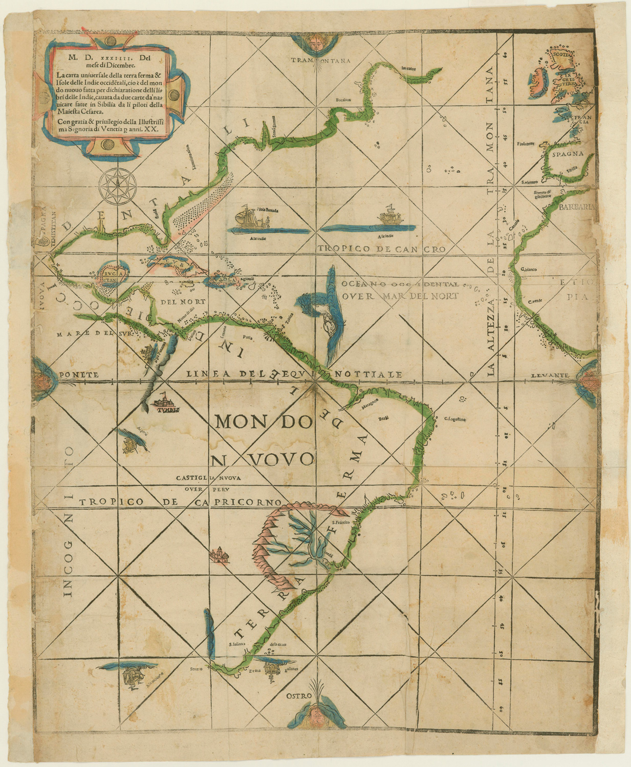
La carta universale della terra ferma & isole delle Indie occide[n]tali [Map of all the lands and islands of the West Indies]. Place and date of publication: Venice, 1534. Courtesy of the John Carter Brown Library, Providence.
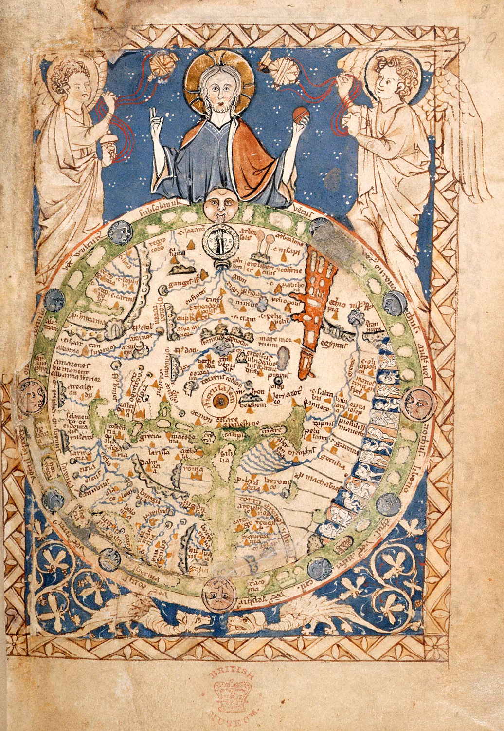
Psalter, with additional hymns and prayers and a medieval world map (“The Map Psalter”). Place and date of publication: London, 1262-1300. Courtesy of the British Library, London.
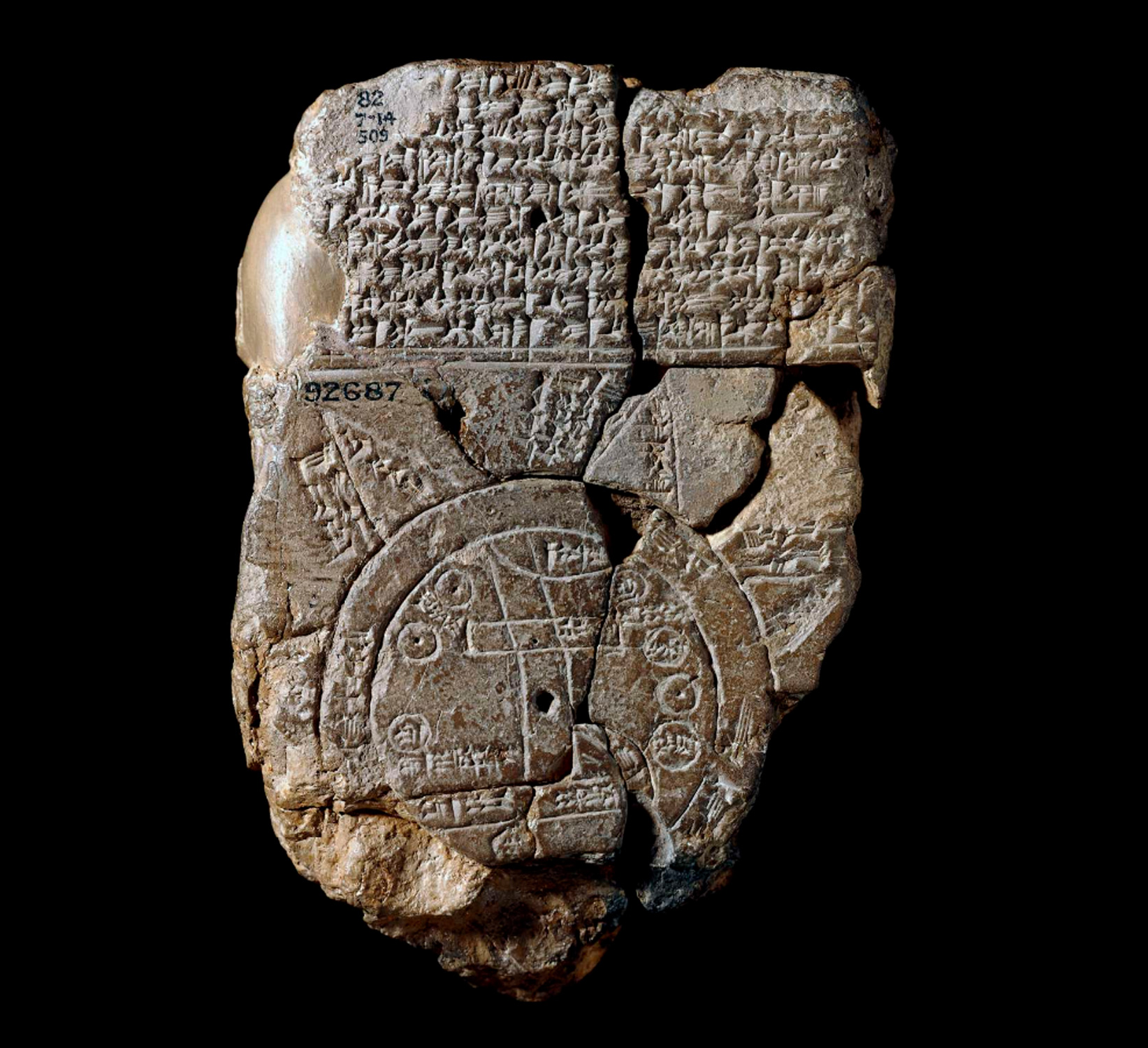
The Map of the World. Place and date of creation: Abu Habba (Sippar), approximately 6th century BCE. Courtesy of the British Museum, London.
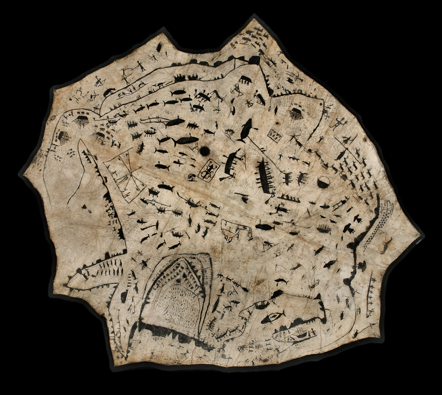
Painting, in black, on sealskin: a large number of small figures, including men in sledges drawn by reindeer, in canoes, harpooning whales, etc. Place and date of discovery: Bering Strait, Russia/Siberia, 1860 or 1870. Taken from the Pitt Rivers Museum, Oxford.
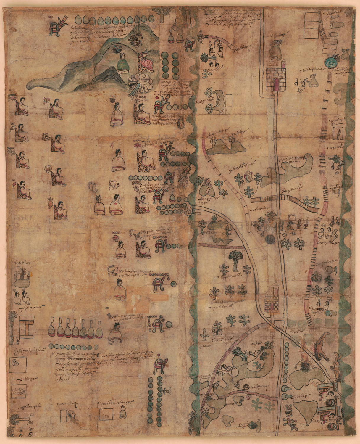
The Codex Quetzalecatzin. Place and date of creation: Mexico, 1593. Courtesy of the Library of Congress, Washington, D. C.
Map of the Crown Prince Islands, Disko Bay, Greenland. Place and date of creation: Disko Bay, 1926. Taken from the Library of Congress, Washington, D. C.
Among the Kogi people of the Sierra Nevada of Santa Marta, for example, the is made as a map that depicts the geography of their home region.
 Key term
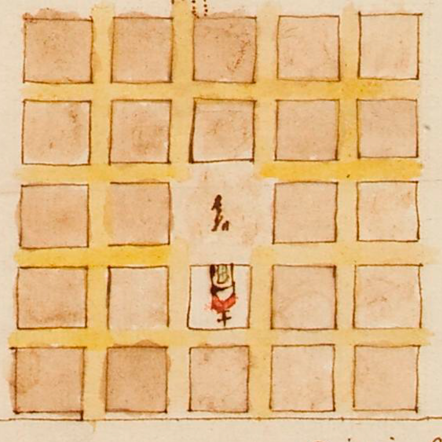
Among the Kogi of the Sierra Nevada of Santa Marta, a loom—in addition to being a tool for weaving—is a map that represents the human body and the geography of the Sierra.
The body of a man with his arms crossed forms the shape of the loom. In turn, the four corners of the loom represent the four cities of the lowlands (Santa Marta, Rioacha, Fundación, and Valledupar), while the crosses that shape the interior represent the mountain peaks.
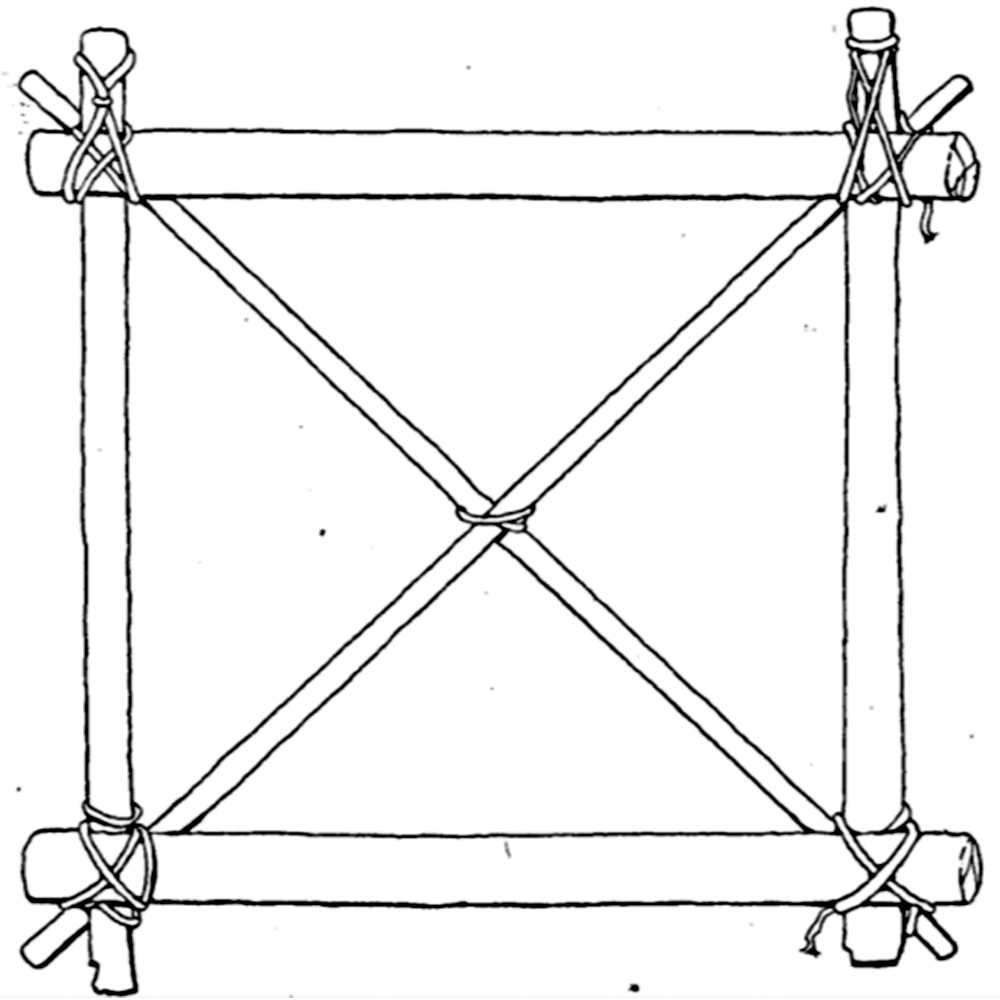
Framework of a Kogi loom [Marco de un telar Kogi]The Loom of Life: A Kogi Principle of Integration. G. Reichel-Dolmatoff, 1978.
The form of the loom creates a frame with which the Kogi conceptualize and represent geography and which can also be expressed on their bodies.
Reichel-Dolmatoff, G. (1978). The Loom of Life: A Kogi Principle of Integration. Journal of Latin American Lore, Volume 4 ( Number 1).
The estate (hacienda) depicted on the painting belonged to Francisco de Maldonado y Mendoza. His descendants obtained titles of nobility and the estate became the center of the Marquisate of San Jorge.
Learn moreThe trial ratified Maldonado y Mendoza’s rights to his estate. In his will, Maldonado y Mendoza transformed his estate into a mayorazgo —an entailed estate. This meant that following his death it would not be divided between his heirs but would pass on to his eldest child, Antonio Maldonado de Mendoza.
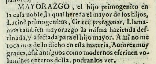
"MAYORAZGO, the first-born son of a noble house, which the eldest son inherits, from the Latin primogenitus, and the Greek protogonos. We also call a mayorazgo the estate or land destined and allotted to the eldest son. It is beyond our purpose to say more on this subject, as major authors, classical and modern, have written whole volumes on it, which may be consulted.” Tesoro de la lengua castellana, o Española. Sebastián de Covarrubias Orozco 1611. Courtesy of John P. Robarts Research Library, Toronto.
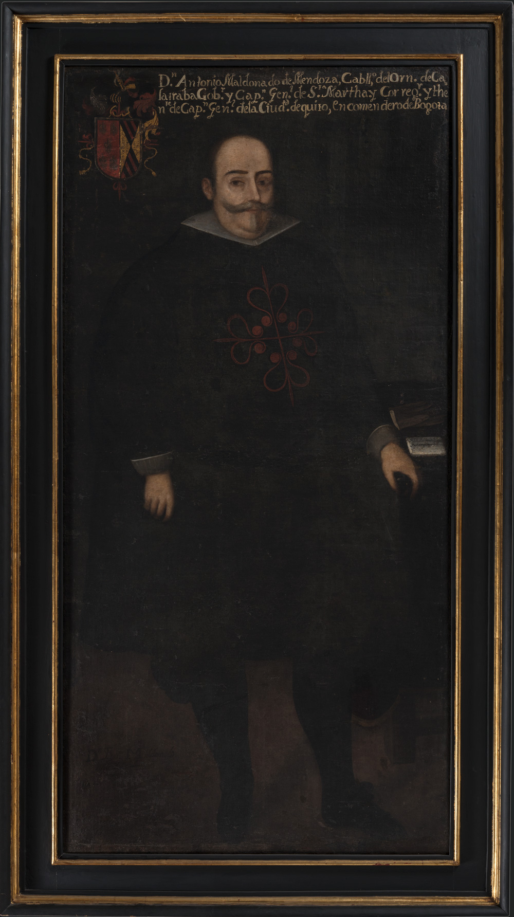
Antonio Maldonado de Mendoza. Anonymous, 18th Century. Courtesy of the Museo Colonial, Bogotá.
This was the beginning of a powerful lineage that grew around the estate.
This property was known as the “Meadow of Bogotá,” the mayorazgo of Bogotá, or the Steer Yard, because the estate temporarily held cattle driven up from the lowlands for consumption in the city of Santafé de Bogotá. Maldonado y Mendoza’s heirs continued to marry into some of the most distinguished families in the New Kingdom of Granada, and eventually received titles of nobility and established the Marquisate of San Jorge.
The lineage maintained its power for two centuries, producing viceroys and bishops. As a matter of fact, who became the first president of the republic in 1811, was a descendant of the Maldonados.
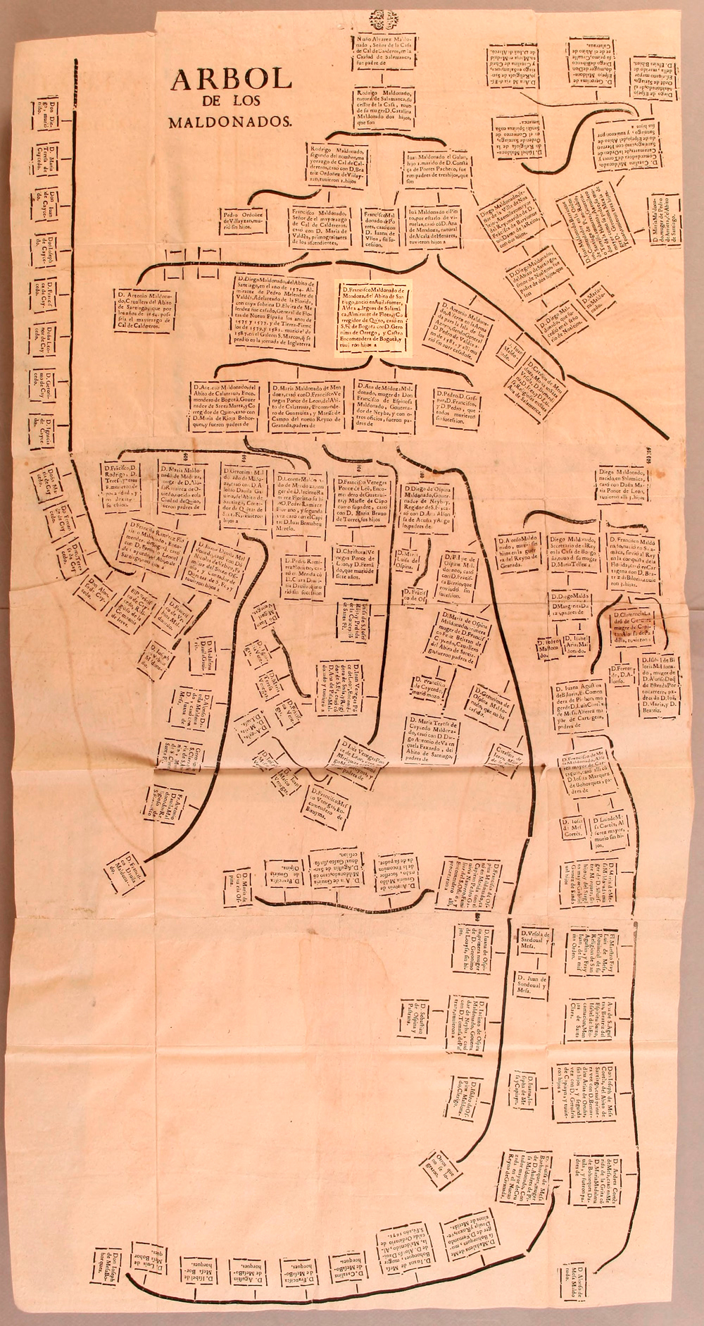
Maldonado Family Tree. Libro Segundo de las Genealogías del Nuevo Reino de Granada. Juan Flórez de Ocáriz, 1674. Courtesy of John Carter Brown Library, Providence.
Antonio Maldonado de Mendoza. Anonymous, 18th Century. Courtesy of the Museo Colonial, Bogotá.
Key termJorge Tadeo Lozano was born in Bogotá in 1771. He studied in Europe and became interested in natural history. This allowed him to join the Royal Botanical Expedition in New Granada in 1803 as the person in charge of the zoological project. Given his high social and economic status, Lozano owned numerous estates in different climates, which made collecting animals for his zoological work easier. He went on to write The Fauna of Cundinamarca and participated in the publication of Correo curioso, erudito, económico y mercantil de la ciudad de Santa Fe de Bogotá, one of the first enlightened journals of the Republic. His work was part of the Spanish Crown’s wider search for ways to promote colonial economies through scientific expeditions during the Enlightenment, specifically aiming to identify new products and commodities for export.
As part of his administrative duties within the Spanish empire, Lozano was named lieutenant protector of the Indigenous peoples of Bosa, Fusagasugá, and Usaquén in 1807. With the consolidation of the first government of the Republic, Lozano served as the first president of the United Provinces of New Granada, only to be deposed in 1811 in a coup d’état led by Antonio Nariño. After the Reconquista, Pablo Morillo’s forces shot Lozano on July 6th, 1816 for his participation in republican politics in what is now the Plaza de Los Mártires.
Europeans coined the term “indios” to group the different societies of the New World into a single category. This practice originated during Christopher Columbus’s first travels. The label imposed many negative stereotypes on Indigenous populations.
Learn moreIn 1492, Columbus left Spain in search of Asia and always believed that he had reached the East, or India, where John de Mandeville had claimed there were whole societies composed of marvelous creatures, such as men with dog snouts. Europeans projected many of these ideas onto the inhabitants of the New World, calling them “indios.”
This arbitrary category became the basis for the classification of the inhabitants of the New World. In the sixteenth century, Spanish scholars and theologians debated intensely about whether the “indios” were rational beings, like Europeans, or inferior beings whose nature made their enslavement necessary. In this way, the great social complexity and ethnic diversity of the societies of the Americas were reduced to the term “indio,” a negative and violent term that infantilized them and defined them as beings that needed to be trained to adopt European habits and ways of life.
Primary Source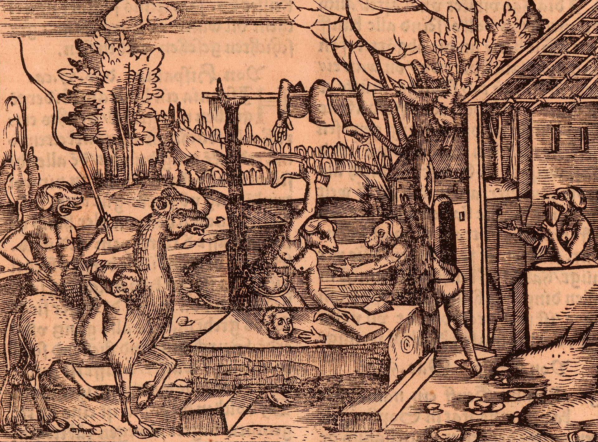
“Cynocephalus.” Von Canibalien dem folck von Canaria, 1527. Courtesy of John Carter Brown Library.
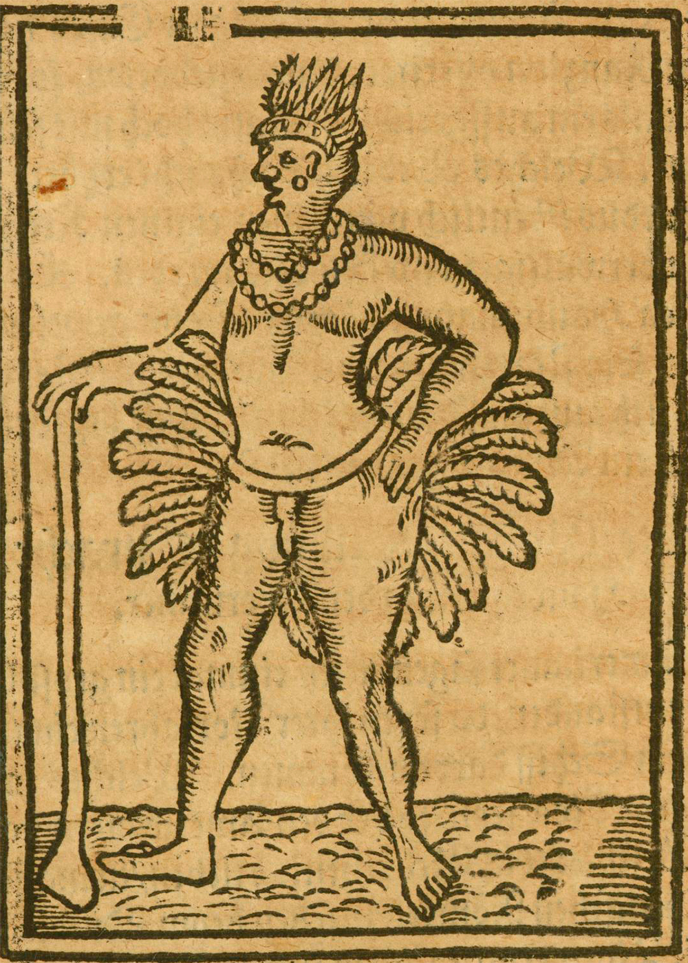
“Indios.” Americaner in Peru, 1612. Courtesy of John Carter Brown Library.
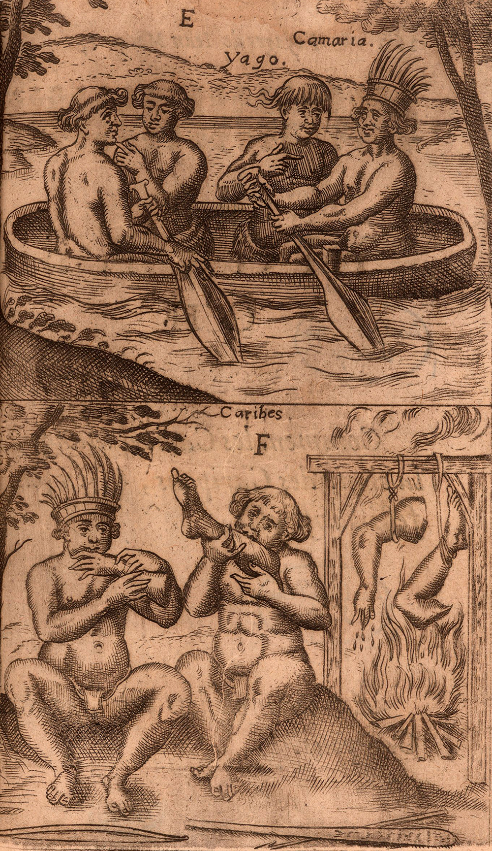
La Figure E. F. Formes des cannoes ou batteaux des Caripous & autres Indiens. Comment les Caribes boucanent & mangent la chair de leurs enemies, 1665. Courtesy of John Carter Brown Library.
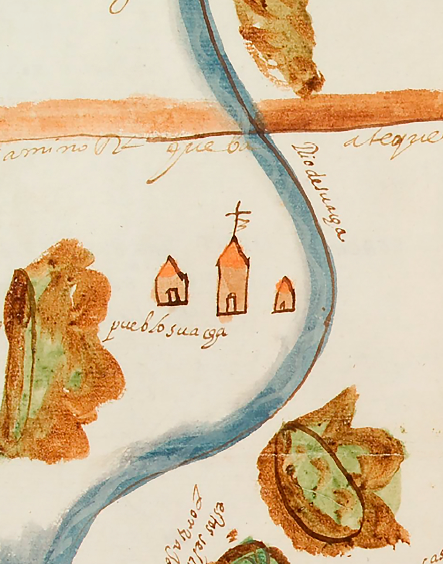
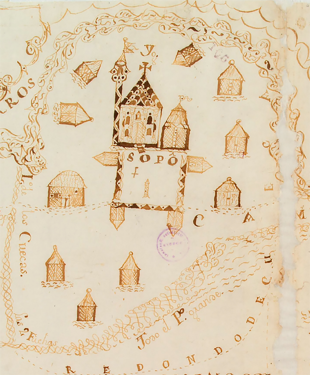
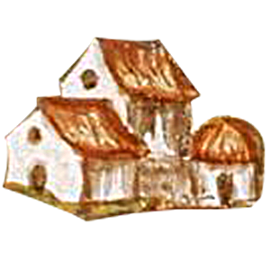
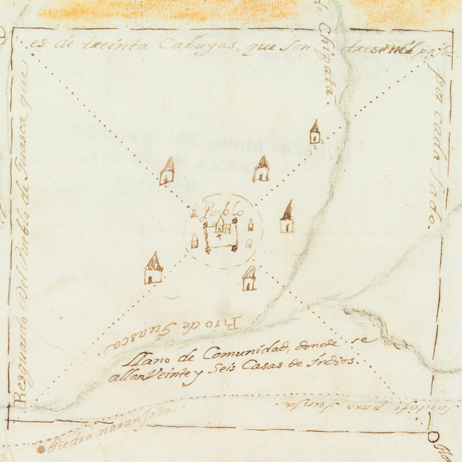
The towns that today populate the savanna were not always there, but were the result of a project set in motion by the Spanish empire aimed at making “indios” live Catholic lives (what they referred to as “life in good order”).
Learn moreThis process, which the Spanish called “reducir,” (“to reduce or order”) forced Indigenous people to abandon their homes and move to new settlements organized around a main square in a grid-like arrangement, following Catholic organization. Central Imperial hierarchies and forms of social control were visible in the main square of reducciones, where the church, jail, cacique’s residence, and native nobles’ homes were situated, while commoners’ houses extended outward from the center of the grid. Imagined as an ideal and divine space, the orthogonal grid was applied to several Iberian cities in the medieval period, but it was in the Americas that it thrived, replicating itself consistently after the installment of some of the first colonial cities in the Caribbean, including Santo Domingo (1502), Santiago de Cuba (1515), Havana (1522), and Cartagena (1533). The same grid organization was applied to massive resettlement projects of Indigenous peoples in Peru, Mexico, and many other areas. In this way, the grid became the main form of urban design for the Indies even before the creation of the first urban code, Philip II’s Ordenanzas de Poblaciones of 1573.
We can see a variety of villages on the map, such as Fontibón, today part of the city of Bogotá, or Serrezuela, now called Madrid.
Many of the names of municipalities in use today used to be elaborate Muisca political categories. Terms like Ubaque, Guatavita, Bogotá, and Duitama simultaneously designated a political leader, a territory, and a community. After Indigenous peoples were forced into reducciones, the colonial villages would keep the name of the Indigenous and its political structure, but its inhabitants would be forced to live under a different spatial and cultural order.
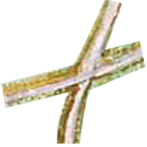
After the reducciones, crosses and Catholic symbols dominated the landscape and churches became the most common landmark in colonial villages.
Primary Source Primary Source
 Key term
The Spanish began to use the terms “cacique” and “cacicazgo” in the islands of the Caribbean after they noticed that Indigenous peoples used these Arawak words to refer to their authorities. From then on, the Spanish used these as generic terms to refer to Indigenous authorities throughout the empire. The Muisca used the term psihipqua to designate some of these authorities. The caciques that led Muisca communities after the conquest had to change their forms of government in a colonial context in which Indigenous peoples were put under increasing pressure by imperial structures of governance. By the late sixteenth century, the historical record indicates that many caciques dressed as Spaniards, used the title “don” and a European name (like don Francisco de Ubaque), and financed murals, masses, and Catholic celebrations.
Primary SourceThe first instructions for the building of villages were decreed by colonial officer Tomás López Medel in 1559 and they caused many serious problems within Indigenous societies. Reducciones not only created conditions favorable to epidemics due to overcrowding, but also generated conflicts between Indigenous authorities and communities.
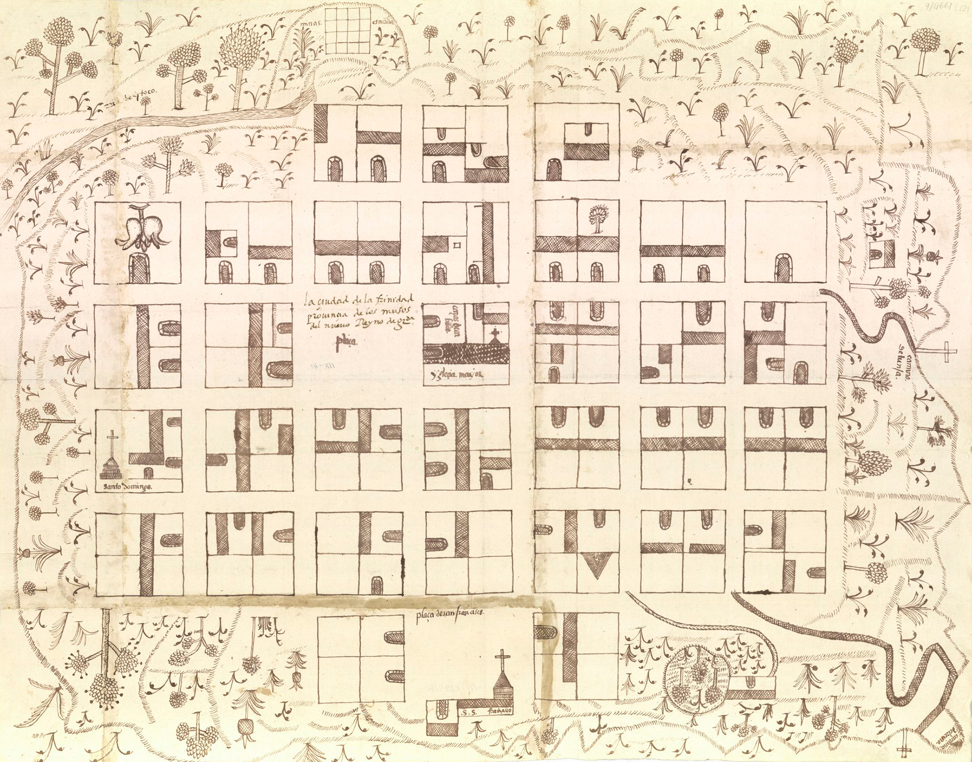
The city of Trinidad, province of Musos in the New Kingdom of Granada, 1582. Courtesy of Real Academia de Historia, Madrid.
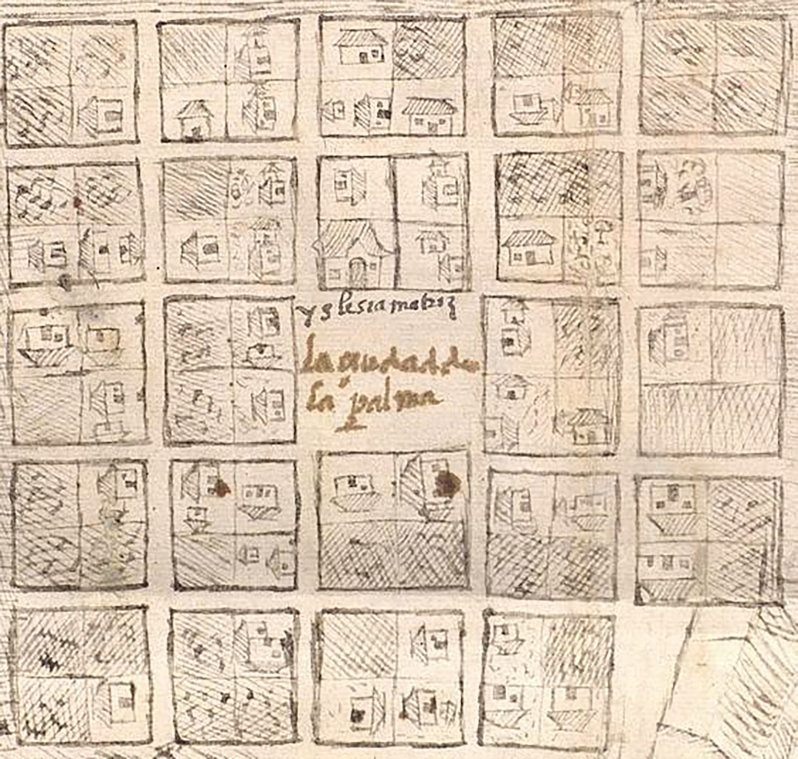
Map of the city of La Palma, 1581. Courtesy of Archivo General de Indias, Seville.
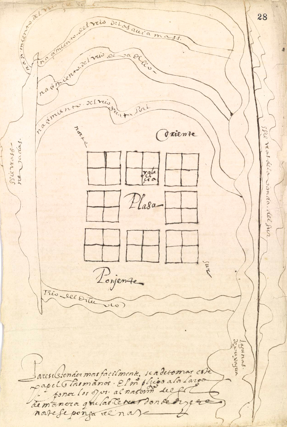
Map of the city of Reyes del Valle de Upar, 1578. Courtesy of Real Academia de Historia, Madrid.
On Fosativa and the village of ChoachíSee full document
Map of the city of Reyes del Valle de Upar, 1578. Courtesy of Real Academia de Historia, Madrid.
Map of the city of La Palma, 1581. Courtesy of Archivo General de Indias, Seville.
The city of Trinidad, province of Musos in the New Kingdom of Granada, 1582. Courtesy of Real Academia de Historia, Madrid.
Sobre Fosativa y el pueblo de Choachí.Cortesía del Archivo General de la Nación (Bogotá), Visitas Cundinamarca, t. 12, ff. 1047-1050.
On the map we can see where the “old palisade of the cacique” used to be. In the sixteenth century, the Muisca of the Savanna had ceremonial centers that were known as “palisades.” These played an important role in their political organization.
Learn moreThis territory has a long human history. About 12,400 years ago, in the late Pleistocene period, human populations dedicated to hunting, fishing, and gathering fruit ascended the valley of the Magdalena River until they reached the high plateau of the eastern range of the Andes and found refuge in its rocky shelter. Between 5,000 and 7,000 years ago, they left their settlements and moved to open air lands.
During the following millennia, these groups perfected the use of ceramics and developed denser farming communities. By the year 1,000 AD they had organized themselves in chiefdoms and two centuries later those chiefdoms left evidence of more centralized political authority, giving rise to the Muisca period. When the Spanish arrived, the Muisca people were organized into agricultural societies with many levels of political hierarchy.
The Muiscas’s built environment was key to their society. Their concept of the house, composed of terms like gue, ca, ie, uta, and for the settlement, with words like gues, bacana or gueganecana, were tied to broader notions of place, time, and the body and were central in expressing identity, kin affiliation, and political organization. For instance, the term guecha, formed by “house” (gue) and “man” (cha), was used to refer to the uncle, the mother’s brother, who was the leader of the household. The word to designate a stranger, gueyba, was also composed of “house” (gue) and “blood” (yba). In other words, the house as a place and as a concept helped the Muisca identify who belonged in their social world and who was an outsider.
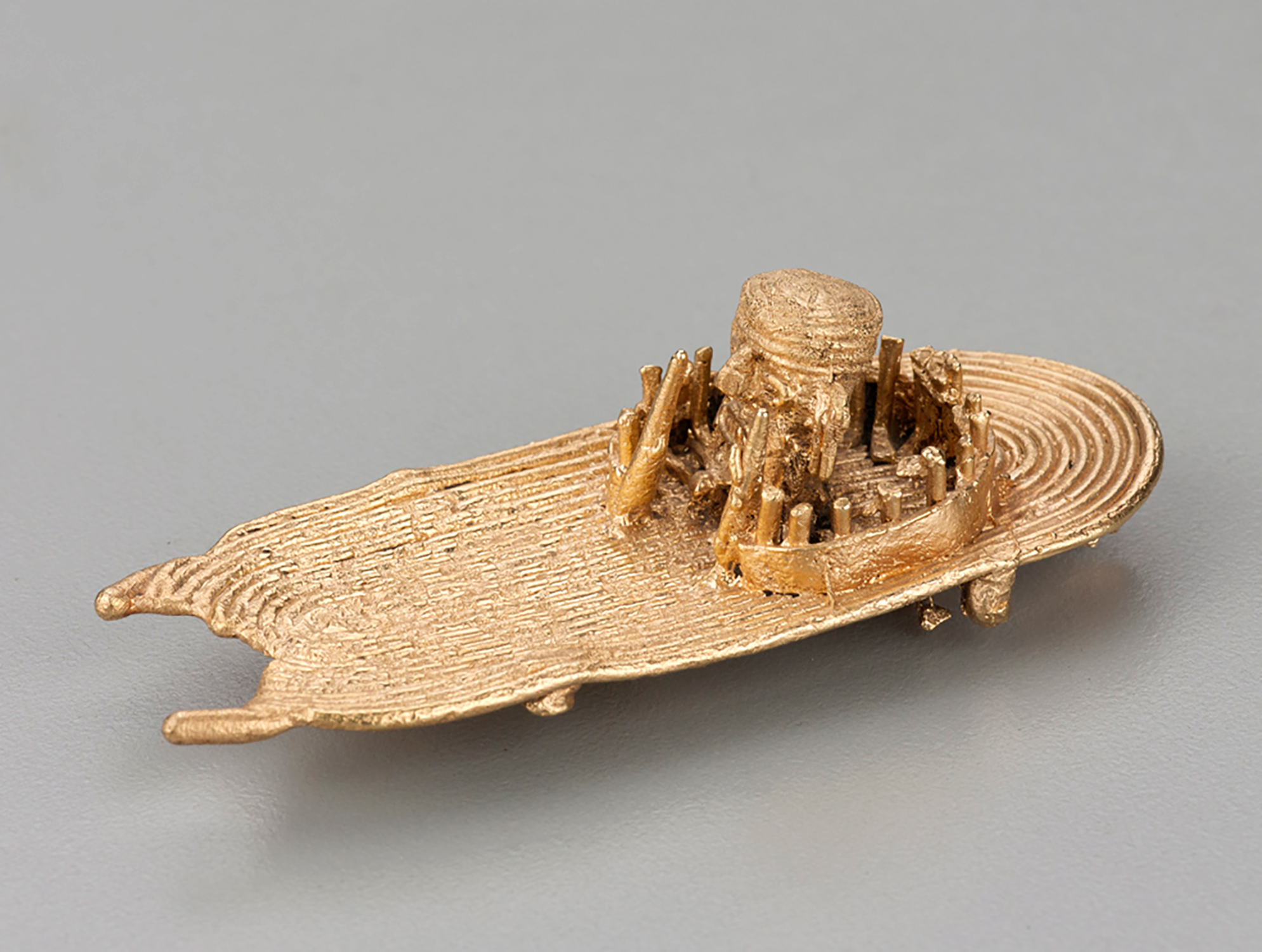
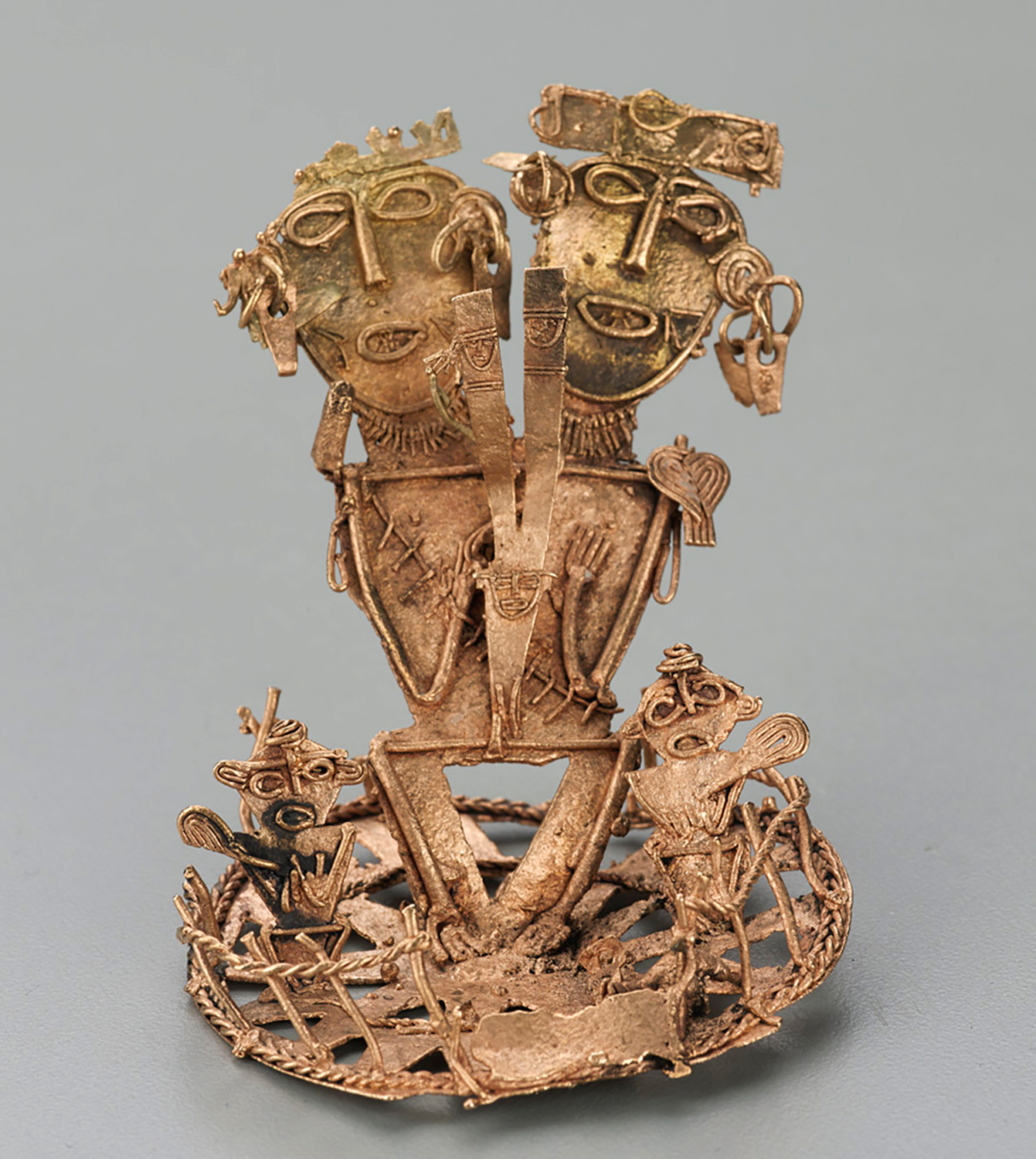
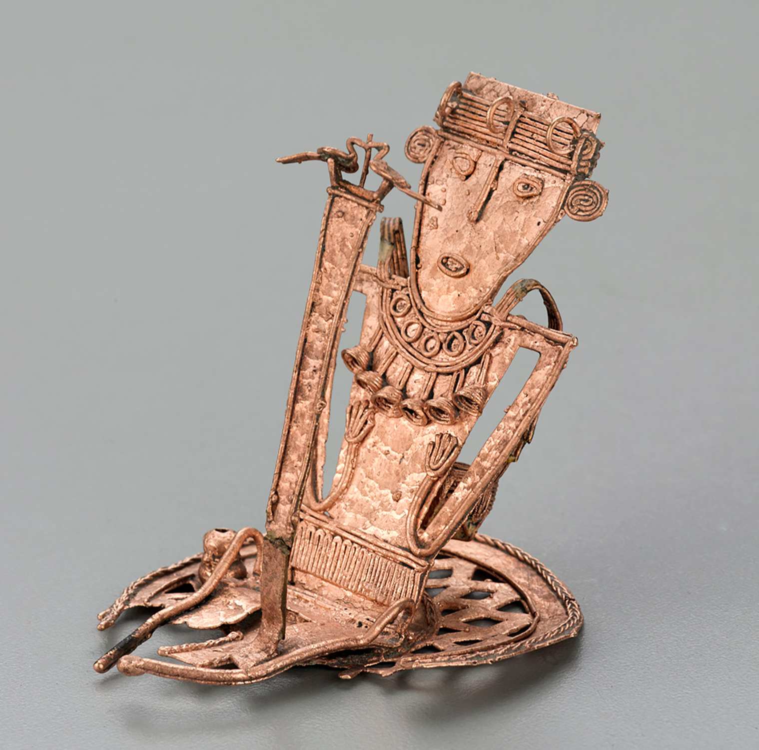
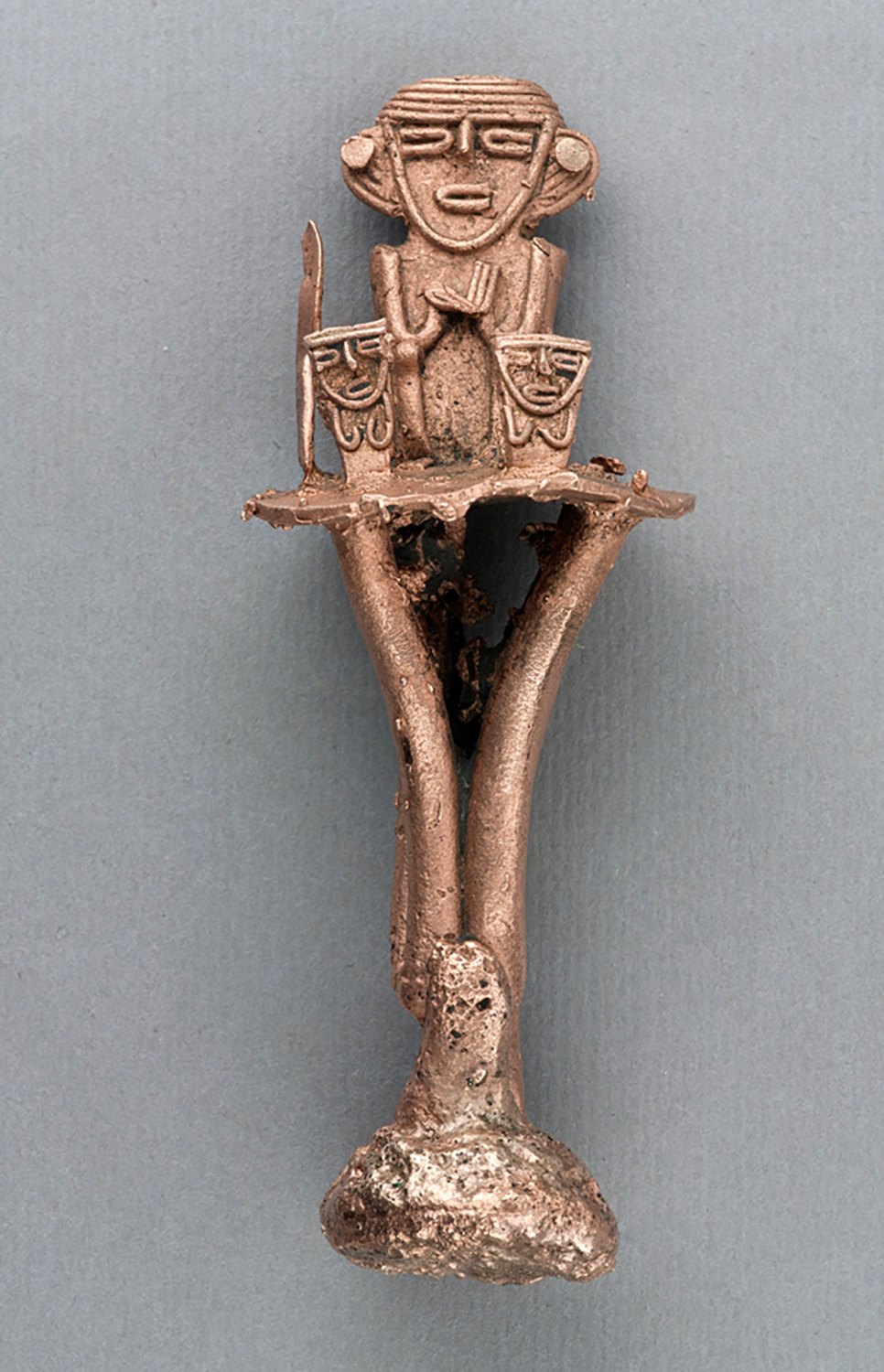
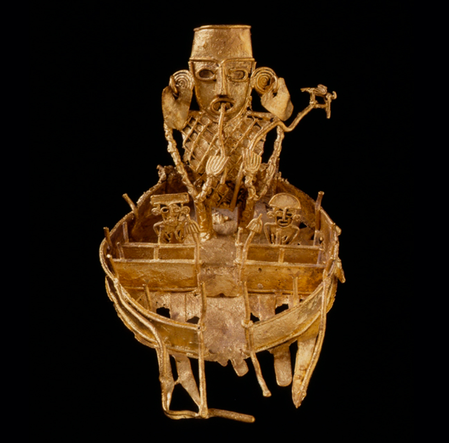
One of the Indigenous spaces that most intrigued the Spaniards was the chief’s cercado (enclosure or palisade). These ceremonial spaces were often decorated with paintings on cotton fabric of different colors and styles, had wide avenues and plazas used for dances and performances, and were surrounded by walls contstructed out of wooden logs. They were built during large, majestic gatherings that united the whole community and involved feasting, singing, and many types of colorful masks and costumes. The meaningful objects displayed in these ceremonies included feathers, shells, dear hides, and even the heads of jaguars and pumas. The palisades were associated with chiefly authority and Muisca goldsmiths left testaments to these places in their artwork.
Primary Source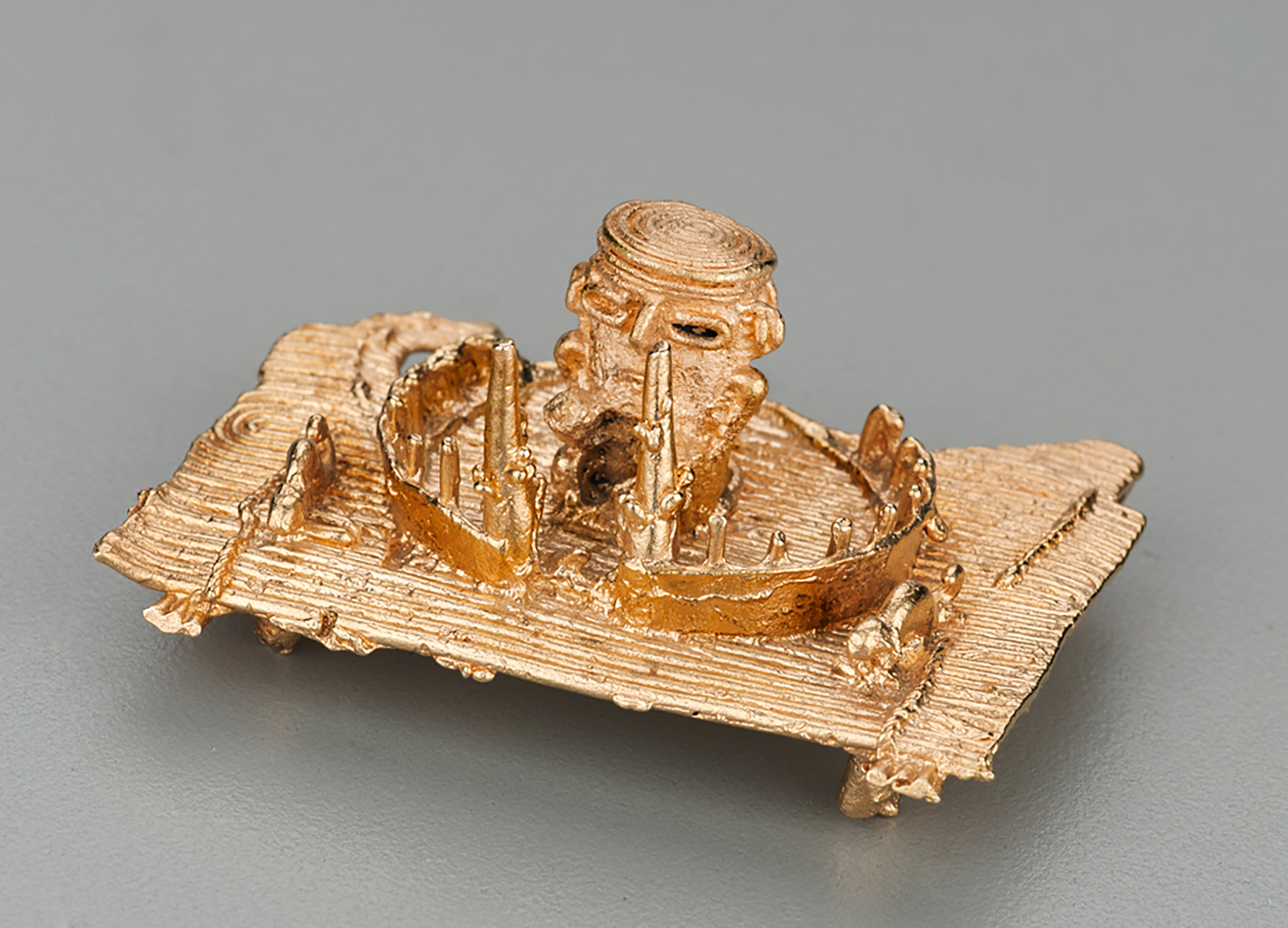
Votive figure in gold filigree. Eastern Range – Muisca. Date: 600¬-1600. Courtesy of the Museo del Oro (Bogotá).
Votive figure in gold filigree. Eastern Range – Muisca. Date: 600-1600. Courtesy of the Museo del Oro (Bogotá).
Votive figure in gold filigree. Eastern Range – Muisca. Date: 600-1600. Courtesy of the Museo del Oro (Bogotá).
Votive figure shaped as an enclosure in gold filigree. Eastern Range – Muisca. Date: 600-1600. Courtesy the of Museo del Oro (Bogotá).
Votive figure shaped as an enclosure with anthropomorphic figures in gold filigree. Eastern Range – Muisca. Date: 600-1600. Courtesy of the Museo del Oro (Bogotá).
Golden object in the form of a palisade. Cundinamarca/ Colombia, Courtesy of the Ethnological Muscium of the Berlin State Museums.
Another significant symbolic space was the quca, the building where the Muiscas’ political and spiritual leaders were trained. The trainees would be secluded for years in the quca keeping a strict diet and weaving textiles. Their textiles would remain inside the quca after their release, adding to its cultural significance. This building was often within the cercado itself. The word quca is closely associated with quyca, which referred to land, region, myth and cosmology, disease, history, and narration. Qucas were key to history telling, knowledge production and transmission, and the prestige of the Muisca leaders.
Colonial officers deemed all these spaces and objects diabolical since they perpetuated Indigenous cultural practices and often rivaled the teachings of friars. They sought to erase them as they forced the Muisca to reside in the gridded villages. In a dismaying account from 1600, Jesuit Alonso de Medrano described how friars had forced the spiritual leaders of the Indigenous settlement of Fontibón to tread on their sacred objects, spit on them, curse them, and then burn them.
Primary SourceThe creation of towns was part of a set of measures aimed at creating two separate “republics” with different legal responsibilities: one of indios living in towns and another of Spaniards living in cities. This is why the “town of Bogotá” and the city of “Santa Fe” appear as different places on the map: the town of Bogotá where Funza sits today, and the city in the place of contemporary Santafé de Bogotá.
Learn moreAlthough in theory the two republics were meant to remain spatially separated, this division was not applied as rigorously in practice. Colonial villages for “indios” continued to be places with vibrant economic activity to which vecinos, who did not identify as indios, also gravitated.
In fact, during the sixteenth and seventeenth centuries, many villages for “indios” had larger populations than cities like Santafé de Bogotá and Tunja. Likewise, Santafé de Bogotá had a large number of Indigenous people employed as merchants who sold goods and provisions on the main road and were often registered as owners of building lots (solares).
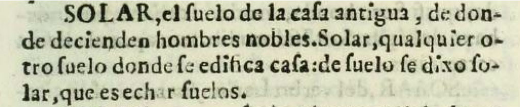
"SOLAR, , is the land of ancient homes, from which noblemen descend. Solar is any other land on which a house is built: from suelo, or floor, comes solar, which is to set a floor.”
Tesoro de la lengua castellana, o Española. Sebastián de Covarrubias Orozco, 1611. Courtesy of John P. Robarts Research library, Toronto.
The Indigenous presence in the city was such that in 1594, the president of the Audiencia de Santafé, Antonio González, saw the need to create a new administrative position for a Spaniard who would be charged with supervising and controlling the activities of the Indigenous population.
The distinction between the town of Bogotá and the city of Santafé was maintained until the nineteenth century, when the republican government eliminated some Spanish names in an effort to create national symbols, thus erasing Santafé and leaving only Bogotá as the name of the city, while the old Indigenous village took the name of Funza.
Primary Source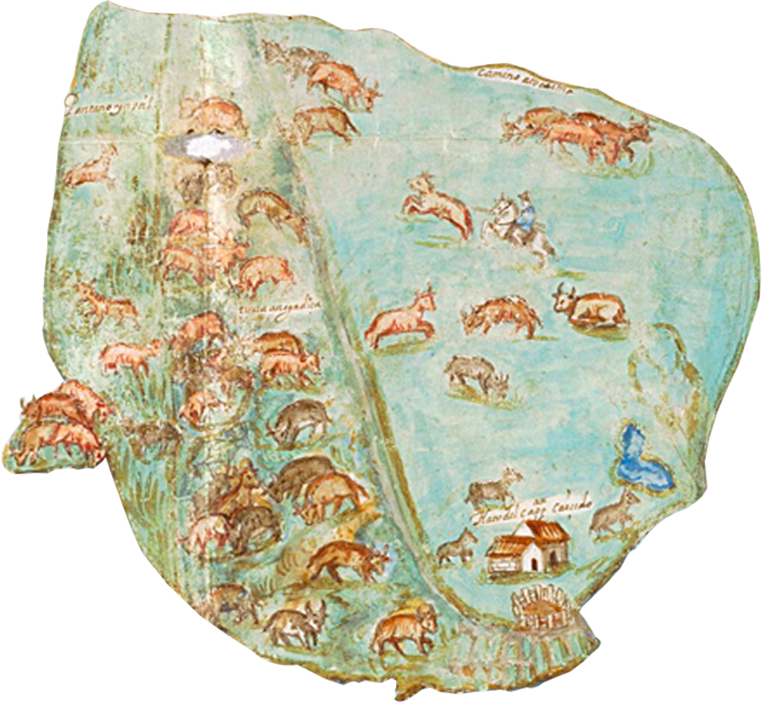
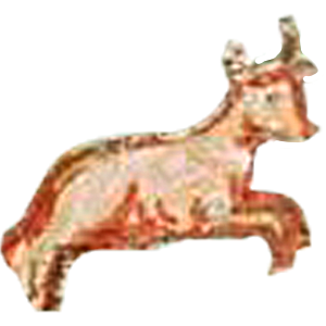
Although the landscape in the map is dominated by animals such as cows, sheep, pigs and horses, none of these animals were native to Andean landscapes.
Learn moreWe tend to think of the European expansion as a human process in which the Spanish, Portuguese, French, and English crossed the Atlantic Ocean and established colonies in the Americas. Nevertheless, the process also involved the movement of plants, animals, and pathogens between the Old World and the New. Maize, chocolate, potatoes, and tomatoes traveled from the New World to the Old World, while cows, pigs, smallpox, wheat, and sugar were transported from the Old World to the New World.
This biological movement had a profound impact on Indigenous life. Smallpox, for example, set off a demographic collapse of Indigenous population in proportions that are still hard for us to imagine. Historians estimate that Colombia did not manage to regain its pre-Columbian population until the early twentieth century.
In the savanna’s water-rich ecosystem, the Indigenous Muisca people designed a system of cultivation terraces made up of raised beds and elevated platforms. The terraces, in turn, were traversed by ditches that drained the excess water and served as fishing canals.
Learn moreThis style of cultivation generated a diet rich in agricultural products and fish, as well as guinea pigs and deer, although Indigenous authorities controlled access to the latter.
Maintaining these raised beds required a great deal of work and produced both a natural and a human agricultural landscape.
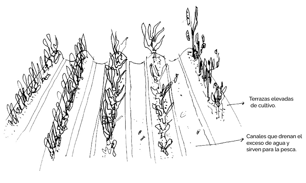
Diagram of the raised-bed cultivation system.
In the painting it is evident that the arrival of animals from the Old World had transformed the environment of the Andes. In fact, the painting shows us a landscape of cattle grazing lands, which already implies a transformation with respect to native landscapes. Nevertheless, we can still see the traces of the raised-bed system in aerial photographs from the 1950s, which show a different way of inhabiting this environment.
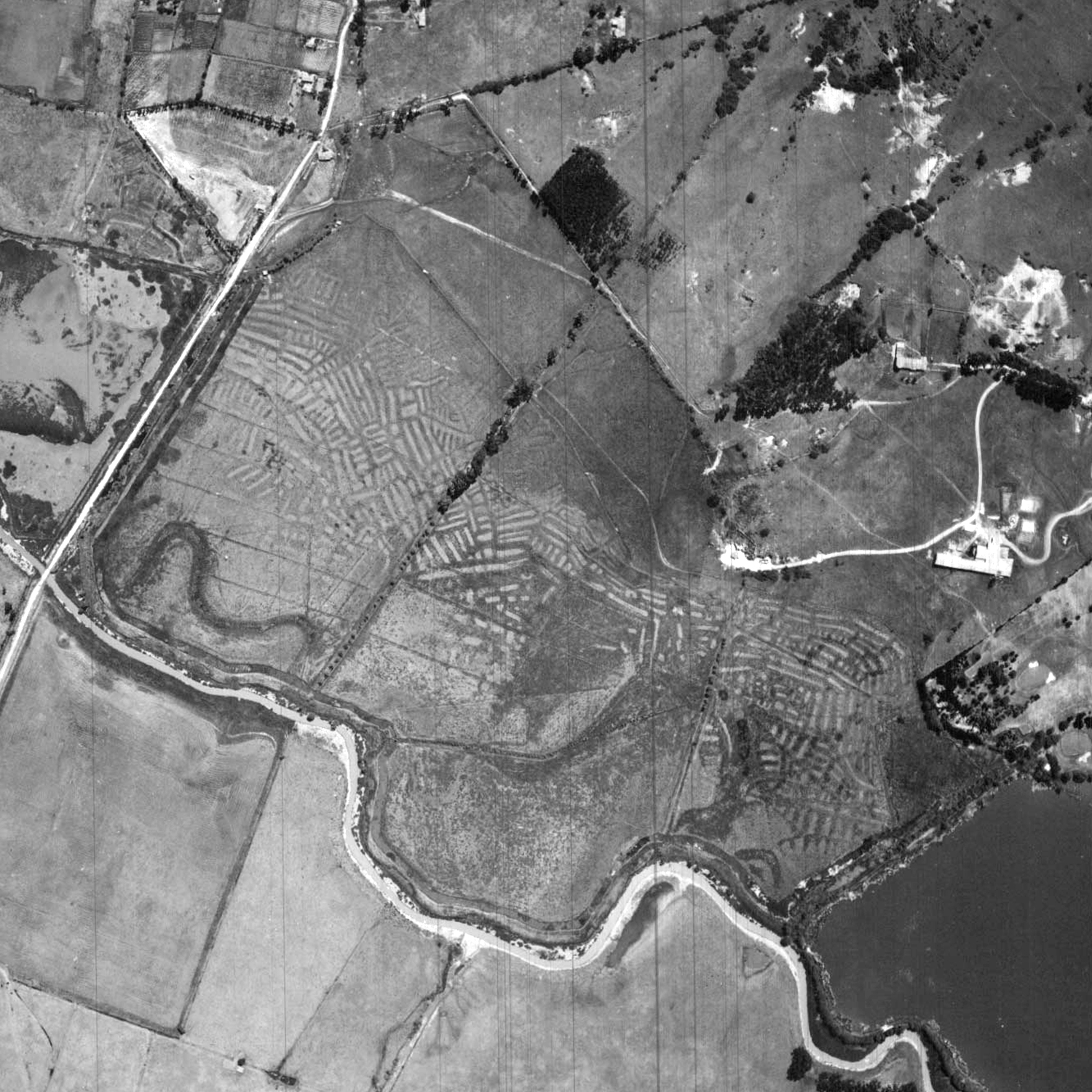
Flight C-778, Photo 869. Place and date of creation: Bogotá, 1956. Taken from the Instituto Geográfico Agustín Codazzi, Bogotá.
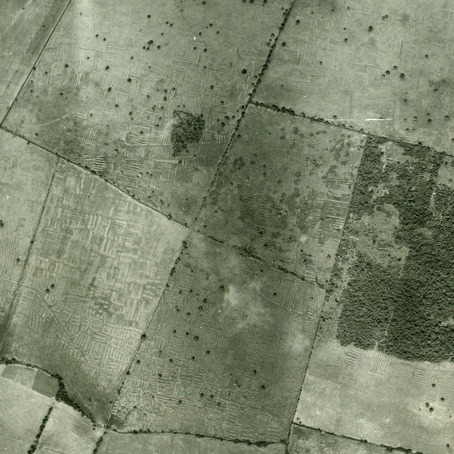
Flight C-773, Photo 014. Place and date of creation: Bogotá, 1956. Taken from the Instituto Geográfico Agustín Codazzi, Bogotá.
Primary SourceThe introduction of cattle raising following the Spanish invasion changed the landscape of the savanna forever. The raised-bed and canal systems were not practical from the perspective of ranching. For this purpose, it was more useful to level the terraced fields and convert the landscape to .
Learn moreThese grasslands, however, were not well suited to the hydrological dynamics of the eastern range of the Andes and tended to flood. For this reason, some Spaniards described these lands as “useless” and “swampy,” as indicated in the map’s title. Nevertheless, by the early seventeenth century the Bogotá savanna was populated by a large number of sheep, chickens, cows, pigs, and horses.
From the point of view of Indigenous peoples, these were intruders that not only damaged the raised-bed system but often trampled their crops and forced them to build fences to keep them away.
Yet the arrival of new plants and animals did not only have negative consequences. By the early seventeenth century, Indigenous peoples had begun to incorporate eggs and chicken into their diet and began making their textiles from sheep’s wool. The newcomers were now bound up in the landscapes of the Andes and the Indigenous and Spanish economies.
Key termThe grasslands represented in the Painting are probably not the same ones that cover the savanna today. In the eighteenth century, herders began importing African grass varieties that produced better grazing lands for cattle, though it is possible that these types of grasses had begun to spread in the New World previously since they were used for bedding on ships used in the slave trade..
Key termCattle farming is part of a long process of coexistence between humans and animals known as “domestication.” Although domestication has traditionally been seen as a process in which humans dominated and tamed animals, recent research shows that this process was not fully controlled by humans and that many animals approached and coexisted with human societies of their own accord. In Africa and Eurasia, cattle farming has been practiced for at least 6,000 years, and in Spain, a livestock culture took shape throughout Antiquity and the Middle Ages as part of a network of trade and connection with other parts of Europe, the Middle East, and Asia. This form of livestock farming—centered on raising cows, sheep, goats, and pigs—depended on the use of horses and dogs to control freely-roaming livestock.
Indigenous societies in the New World had domesticated many animals, including dogs, turkeys, and ducks, which they used for food and in rituals, traded, and gave as tribute. In the Peruvian and Bolivian Andes, camelids, such as lamas and alpacas, were also raised and used as pack animals and for their wool. These were the only animals to be raised in large herds. When cows, pigs, and sheep were introduced into the New World after the Spanish invasion, they flourished quickly and adapted easily to an environment lacking in natural predators. Along with these came other unwanted species such as the Norway rat. Animal populations grew to such an extent that historian Elinor Melville has referred to the reproduction of ovine herds in Mesoamerica as “the plague of sheep.”
Primary Source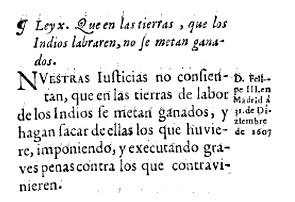 Primary Source
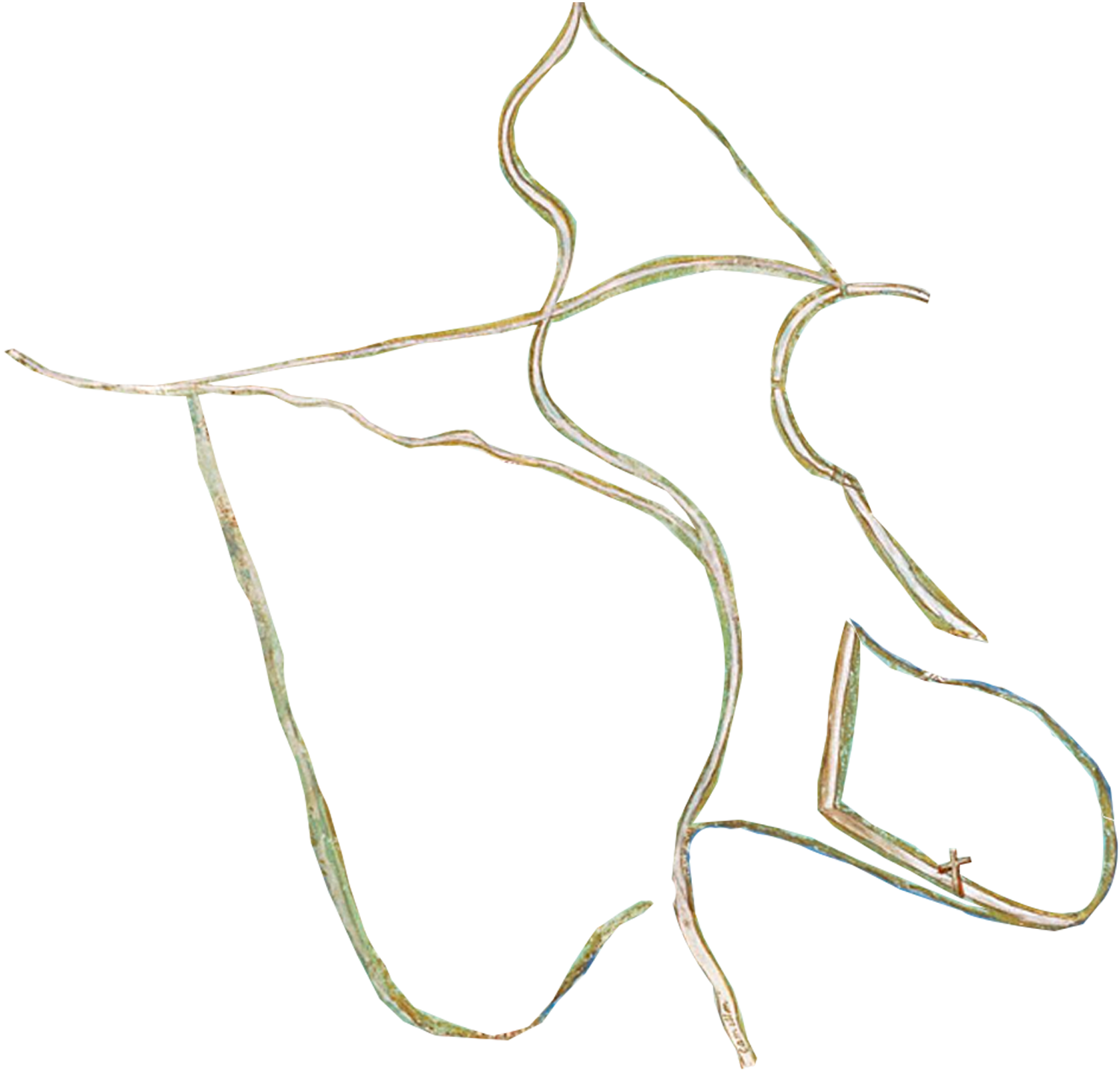
Resguardos were communal lands that Indigenous people could farm. They came about as part of the legal reform of 1593, known as the land compositions (composiciones de tierras). Until then, most lands had remained in the hands of Indigenous people.
Learn moreThis reform introduced a new legal framework that divided agricultural property into two categories: estates for Spaniards and resguardos for Indigenous people. Tomás López’s 1559 reforms had created villages in which Indigenous people would live in a Catholic way, and now the resguardos dictated which lands they were allowed to farm.
Resguardos gave Indigenous people “possession” over bounded pieces of land, but excluded the right to sell it. Meanwhile, estates were treated as private property that could be bought and sold at the owner’s will.
Town of Guasca, made by Fray Manuel Félix de Velasco, 1758. Courtesy of Archivo General de la Nación, Bogotá.
Town of Suta, 1803. Courtesy of Archivo General de la Nación, Bogotá.
In 1593—the same year as the reform—the then Audiencia president Antonio González created an administrative mechanism for a Spaniard to distribute Indigenous labor. This new official was authorized to tell Indigenous people where to work and to regulate how they managed their affairs.
Learn moreThe legal reform of 1593 also provided guidelines for managing Indigenous labor. For this purpose, audiencia president Antonio González created new position under the title of “corregidor de naturales” (administrator of Indigenous people). The alleged purpose of this position was to protect Indigenous people from being mistreated by their encomenderos.
President González envisioned the corregidor as a powerful, intimidating figure. He ordered that when an Indigenous person confessed a crime to a priest, “the priest would secretly inform the corregidor, who in turn would punish the indio according to the fault, negligence, or crime, without exposing the priest as the source of the punishment, and in this way we will achieve what is most desired, that is, that indigenous people love the priest and fear the corregidor.”
Contrary to its stated intention, the new position did not give Indigenous people more autonomy. In fact, it gave the corregidor the power to force Indigenous people to work on estates and in mines. This work was meant to be paid, but Indigenous people did not have complete autonomy over how they spent what they earned.
On the contrary, the law specified that Indigenous people had to put their money in a “chest with three keys”—a special type of coffer that could only be opened if three keys were used simultaneously. One of these keys was kept by the cacique, another by the corregidor, and the third by the “doctrinero” (a priest assigned to an Indigenous parish). In this way, the corregidor and priest could ensure that Indigenous people paid their taxes and tithes before they incurred other expenses.
The corregidores de naturales became key players throughout the Spanish empire in the sixteenth century. It was a coveted position that drew interest from many individuals with global backgrounds, who had, for instance, fought for the king in Flanders or the Mediterranean and now sought a comfortable reward from the crown—a reward at the expense of Indigenous communities. Corregidores in other parts of the empire even enforced types of imperial demands that have not been documented in the New Kingdom of Granada, such as the forced sale of goods at prices they set themselves—a very unpopular practice called the repartimiento de mercancías.
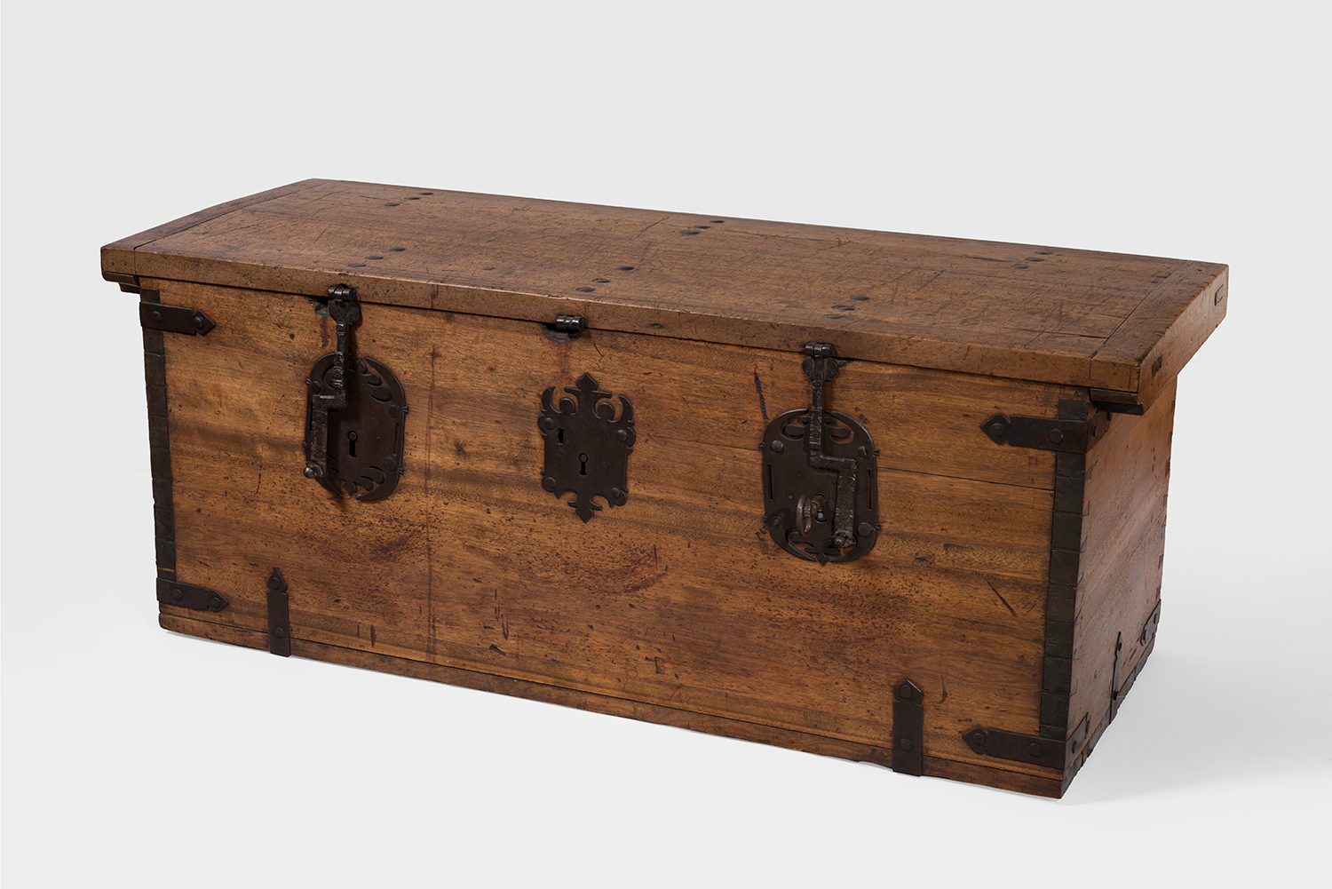
“What is gained… shall be placed in a chest with three keys, one key should be kept by the corregidor, another by the doctrinero, and the other by the cacique.”
Anonymous, chest with three keys, 18th Century. Wood with iron fittings (Wood and metal). Courtesy of the Colonial Museum of Bogotá.
Primary SourceResguardos were created at a time when the imperial administration defined Spaniards and Indigenous peoples as having different economic capacities: Spaniards had extensive commercial lands while Indigenous people had restricted economies supervised by the imperial administration. Indigenous people lost access to about 95% of the lands that had been available to them for farming before the conquest.
In this sense, this is a profoundly violent map. It is a map of land dispossession and of the transformation of the Indigenous agricultural landscapes into grazing pastures for Spanish estate owners—estates on which Indigenous people were forced to work. A few details on the map reveal the marks left by this process, such as the place that indicates the location of the former cacicazgo, or the small area allotted to the community’s resguardo, in contrast with the large estates owned by Spaniards.
Villages and resguardos have had a long and unstable trajectory since the sixteenth century, going through waves of confrontation and resurgence. Most municipalities on the high plateau were former Indigenous villages. In the case of resguardos, after many attempts to dismantle them during the eighteenth and nineteenth centuries, the Political Constitution of 1991 made it possible for them to become ethnic territories once again and since then resguardos have offered Indigenous peoples with new possibilities of ethnic autonomy.
Learn moreIndigenous villages were the axis of social life in the high plateau during the seventeenth century, providing services to everyone living outside cities. In fact, 94% of settlements in the New Kingdom of Granada were villages, while only 6% were cities or villas [towns for Spaniards]. The population that did not identify as Indigenous—people from all walks of life grouped under the term vecinos—grew progressively from the sixteenth to the seventeenth centuries, as the Indigenous population diminished due to factors such as epidemics and the rigors of labor. Imperial authorities took different measures to deal with this demographic change. At first, they implemented the policy of agregaciones (aggregations), which consisted of uniting two or more Indigenous villages into a single settlement.
By the late eighteenth century, the people who identified themselves as vecinos and not as “indios” had become the majority, and Muisca was no longer the main language of communication. As a result, imperial official Francisco Moreno y Escandón tried to dismantle the prevailing land regulation by transforming “Indian villages” into “parishes for the Spanish” and reducing the area of resguardos in order to allocate more lands to vecinos. Indigenous communities did not passively accept this process and it was in fact one of the main reasons why Indigenous people in the plateau took part in the Revolt of the Comuneros.
The independence movements of the nineteenth century sought to form a republic where there had been an empire, and this implied remaking political institutions. The new republic was based on the theoretical principle that all its inhabitants were “citizens”—free individuals with political rights—and, for this reason, all corporative and community entities were seen as inefficient and backward and had to be dismantled. “Indios” would no longer exist as a legal category, nor would they be subject to special regulations, including the Crown regulations that had imposed higher taxes and labor demands on them and assigned them to resguardos. To this end, the republican state repeatedly issued laws and decrees to end resguardos.
Indigenous people responded to these laws in many different ways. In some cases, they made the laws work in their favor, and in other cases they opposed the dismantling of resguardos. We have evidence that these communal lands survived well into the 1940s, as did some social movements dedicated to ethnic revitalization and land restitution, such as the movement led by Manuel Quintín Lame to establish an Indian Council of the Indies (Consejo Indio de las Indias) to advocate for Indigenous interests.
The tendency toward the dissolution of resguardos was reverted by the Political Constitution of 1991, which recognized Colombia as a multiethnic, multicultural nation and welcomed the existence of ethnic territories. From then on, processes of ethnic resurgence as well as demands for resguardo lands have flourished. On the eastern range, resguardos have been recognized in Cota, Suba, and Guatavita, among many others.
In an unexpected turn of events that unfolded over centuries, an institution designed by the Spanish empire to expropriate Indigenous lands became one of the few contemporary paths for Indigenous people to access land and a way of maintaining ethnic autonomy.
Primary SourcePrimary SourcePrimary SourcePrimary Source